Trail Run Project Logo

Explore a beautiful Pine Barrens trail through various state forests with a variety of scenery.


Your Rating: Rating Rating Rating Rating Rating      Clear Rating
Your Difficulty:
Your Favorites: Add To-Do · Your List
Zoom in to see details
Map Key

54.9

Miles

88.4

KM

100%

Runnable

186' 57 m

High

13' 4 m

Low

768' 234 m

Up

683' 208 m

Down

1%

Avg Grade (0°)

11%

Max Grade (6°)

Dogs No Dogs

Features Birding · Lake · River/Creek · Wildlife

Motor vehicles, bicycles, and horses are not permitted. This can be closed during controlled burns.

Need to Know

Camping is restricted to designated sites. Dispersed camping is not allowed. The GPS routing has been changed to reflect the detour north of Apple Pie Hill shown here: njconservation.org/wp-conte….

Runner Notes

The trail turns to sand road in some spots, which may be dangerous for your ankles when running. Be careful and watch for rocks and roots.

Description

This trail follows a bright pink trail blaze. It is easy to spot throughout your run. At some points you'll have to pass roadways, but it is not difficult to stay on trail. During the run, you'll see many interesting areas, including the Carranza Memorial, which memorializes a Mexican pilot. You'll also reach Apple Pie Hill. Here you can climb the Apple Pie Hill Forestry Lookout Tower to about 205 ft above sea level. From up here, you can have an amazing view of Atlantic City to the east and Philadelphia to the west. Please keep in mind, the tower is only open to the public when a ranger is there. Otherwise it cannot be accessed.

There are picnic areas, campsites, parking areas, restrooms, water sources, and dedicated swimming areas throughout the path.

The trail is a lot of fun and is not too far from the main road of Route 206 and Route 70. If you are a beginner runner and looking for a fun trail, this is definitely a good choice!

Flora & Fauna

Deer and other small animals may be seen on trail. Birds are also very common along the trail. Wild flora such as wild blueberries, pitcher plants, and pine trees are common to see.

Contacts

Shared By:

James S. with improvements by Sharon Bolt

Trail Ratings

  4.2 from 11 votes

#8045

Overall
  4.2 from 11 votes
5 Star
64%
4 Star
9%
3 Star
18%
2 Star
0%
1 Star
9%
Trail Rankings

#47

in New Jersey

#8,045

Overall
41 Views Last Month
5,110 Since Apr 14, 2015
Easy/Intermediate Easy/Intermediate

43%
0%
57%
0%
0%
0%

Photos

Intersection with the Blue Trail
Apr 11, 2018 near Egg Har…, NJ
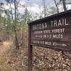
BATONA Trail North - Sign direction sign
Feb 12, 2023 near Egg Har…, NJ
BATONA Trail 16 miles marker.
Feb 12, 2023 near Egg Har…, NJ
Boardwalk along the BATONA Trail
Feb 12, 2023 near Egg Har…, NJ
1808 Trail wood direction sign at the BATONA Trail
Feb 12, 2023 near Egg Har…, NJ
Pink Blaze for the BATONA Trail at Batsto Road
Feb 12, 2023 near Egg Har…, NJ

0 Comments

Weather


Current Trail Conditions

Unknown
Add Your Check-In

Check-Ins

none
Welcome

Join the Community

Create your FREE account today!
Already have an account? Login to close this notice.

Get Started