
 Continue with onX Maps
 Continue with Facebook


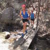
 Particularly Special Place


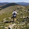
 Intermediate/Difficult
Intermediate/Difficult
Intermediate/Difficult
 Intermediate/Difficult
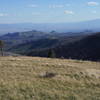
 Picacho Peak from Cerro Gordo TH
3.4 mi 5.5 km • 1,144' Up 348.71 m Up • 1,143' Down 348.43 m Down

 Santa Fe, NM
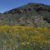
 Chamisa Trail Loop via Saddleback and Windsor
9.9 mi 16.0 km • 1,908' Up 581.68 m Up • 1,897' Down 578.25 m Down
Santa Fe, NM
 Double Baldy with a side of Redondo
18.8 mi 30.2 km • 4,344' Up 1324.03 m Up • 4,343' Down 1323.65 m Down
Santa Fe, NM
Shrine of the Stone Lions AKA Yapashi Pueblo Ruins
12.8 mi 20.7 km • 2,548' Up 776.56 m Up • 2,548' Down 776.52 m Down
White Rock, NM
 Los Alamos County Low Point to High Point
38.0 mi 61.1 km • 9,338' Up 2846.1 m Up • 7,914' Down 2412.07 m Down
Barranca Mesa-Guaje Mtn-Guaje Canyon
6.6 mi 10.6 km • 1,683' Up 513.09 m Up • 1,686' Down 513.85 m Down


 Minor Issues


0 Comments