 Race - Jan 11, 2022
Land Manager: Georgia DNR - Vogel State Park
 Coosa Backcountry
12.7 mi 20.4 km • 3,326' Up 1013.7 m Up • 3,311' Down 1009.17 m Down


 Blairsv…, GA
 Neels Gap - Lake Winfield Scott Traverse
6.2 mi 10.0 km • 1,416' Up 431.71 m Up • 1,615' Down 492.29 m Down


 Blairsv…, GA
 Woody Gap and Dockerty Lake Loop
20.3 mi 32.7 km • 3,301' Up 1006.11 m Up • 3,299' Down 1005.42 m Down


 Dahlonega, GA
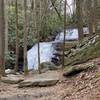
 Long Creek Falls
2.0 mi 3.2 km • 264' Up 80.42 m Up • 264' Down 80.39 m Down


 Ellijay, GA
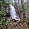
 Denton Creek Falls
2.0 mi 3.2 km • 482' Up 146.96 m Up • 482' Down 146.85 m Down


 Hiawassee, GA
 Beech Creek Trail to Big Scaly Mountain
9.9 mi 15.9 km • 2,649' Up 807.37 m Up • 2,650' Down 807.68 m Down


 Hayesville, NC


0 Comments