
 Continue with onX Maps
 Continue with Facebook


 Particularly Special Place


 Intermediate
Intermediate
Intermediate
 Intermediate
Land Manager: California State Parks - China Camp
 Rocky Ridge and Alpine Lake
4.9 mi 7.9 km • 790' Up 240.94 m Up • 791' Down 241.02 m Down

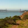
 Mt. Livermore Summit - North Ridge Trail
4.3 mi 6.9 km • 784' Up 239.03 m Up • 783' Down 238.68 m Down
Tiburon, CA
Romancing the Island
13.7 mi 22.0 km • 1,511' Up 460.56 m Up • 1,491' Down 454.31 m Down
Tiburon, CA
Romancing the Island 10K
6.8 mi 11.0 km • 727' Up 221.61 m Up • 705' Down 214.81 m Down
Tiburon, CA
 Hillside Loop
2.5 mi 3.9 km • 255' Up 77.77 m Up • 255' Down 77.75 m Down
 Tamalpa…, CA
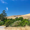
Wildcat Canyon Loop
Tamalpa…, CA
Wildcat Canyon Loop
9.4 mi 15.2 km • 889' Up 270.83 m Up • 892' Down 272.02 m Down
East Ri…, CA


0 Comments