
 Continue with onX Maps
 Continue with Facebook


 Particularly Special Place


 Intermediate/Difficult
Intermediate/Difficult
Intermediate/Difficult
 Intermediate/Difficult
Land Manager: MA DCR-Mohawk Trail State Forest
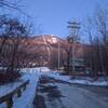
 Mount Greylock Summit Loop
6.6 mi 10.7 km • 2,251' Up 686.23 m Up • 2,246' Down 684.66 m Down

 Adams, MA
Bellows Pipe to Mt Greylock Summit
Adams, MA
Bellows Pipe to Mt Greylock Summit
5.8 mi 9.4 km • 2,231' Up 679.9 m Up • 2,231' Down 679.86 m Down
 Leyden Blueberry Fields
7.5 mi 12.1 km • 1,167' Up 355.66 m Up • 1,188' Down 362.11 m Down
Bernard…, MA
Robert Frost Trail
40.2 mi 64.7 km • 5,360' Up 1633.58 m Up • 5,892' Down 1795.84 m Down
Wendell, MA
 Ledges/Overbrook Loop
2.7 mi 4.3 km • 894' Up 272.42 m Up • 898' Down 273.68 m Down
Pisgah State Park Ridge Loop
7.9 mi 12.7 km • 767' Up 233.82 m Up • 773' Down 235.67 m Down


0 Comments