
Land Manager: USFWS - Minnesota Valley National Wildlife Refuge
 Louisville Swamp Loop
7.3 mi 11.7 km • 439' Up 133.79 m Up • 438' Down 133.5 m Down


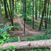
 Surf the Murph
17.1 mi 27.5 km • 1,668' Up 508.52 m Up • 1,658' Down 505.31 m Down
Savage, MN
Lebanon Hills Regional Park
9.6 mi 15.4 km • 569' Up 173.35 m Up • 568' Down 173.26 m Down
Eagan, MN
Holland Lake Lollipop
8.5 mi 13.6 km • 786' Up 239.68 m Up • 787' Down 239.73 m Down
Eagan, MN
 Quaking Bog Loop
1.6 mi 2.6 km • 203' Up 61.98 m Up • 204' Down 62.15 m Down
Saint L…, MN
Lake Rebecca Dirt Loop
7.5 mi 12.1 km • 576' Up 175.53 m Up • 576' Down 175.59 m Down

 Continue with onX Maps
 Continue with Facebook


 Particularly Special Place


0 Comments