Trail Run Project Logo

A steep climb and then descent through the canyons that provides good views of the surrounding mountains.


Your Rating: Rating Rating Rating Rating Rating      Clear Rating
Your Difficulty:
Your Favorites: Add To-Do · Your List
Zoom in to see details
Map Key

1.3

Miles

2.2

KM

62%

Runnable

1,118' 341 m

High

597' 182 m

Low

521' 159 m

Up

474' 145 m

Down

14%

Avg Grade (8°)

28%

Max Grade (16°)

Dogs Leashed

Features Views

Stevens Creek County Park

Need to Know

The Stevens Creek County Park is open from 8:00 am - sunset year-round. The only restrooms are at the trailhead and there is no water for drinking along the trail. There is a small pullout where you can park on Stevens Canyon Road, but there are only a few spots if you want to try to run this trail in reverse order.

No bikes are allowed on this trail.

Runner Notes

The trail is steep, but fairly wide and free from obstructions so you can run up it. On the back side, the trail narrows a little bit and in a couple of place is pretty rocky, but otherwise the trail would be good for training runs for uphill and downhill work.

Description

The Canyon Trail departs from the Stevens Canyon Road from the Canyon Picnic Area and climbs steeply up the hillside before it levels out and descends back to Stevens Canyon Road further up road. If you are looking for a run to train running up mountains, this will provide excellent opportunities to practice steep inclines and declines.

The trail is located behind the restrooms in the Canyon Picnic Area, the only ones in the area, and begins to climb immediately up the hill. The trail is wide and composed of dirt, which makes running very easy at this point. For roughly 0.4 miles, the trail climbs steadily up the hill under the shade of the trees to where the Mount Eden Trail continues straight ahead while the Canyon Trail continues to climb up the hill to the left.

Around the next turn, a group of rocks that have been covered with graffiti sit off to the right hand side of the trail From here, you have another 0.2 miles of climbing ahead to the top of the trail. Views of Fremont Older Open Space and the trails that run along the ridge line can be seen as you approach the summit. Take a minute to enjoy the view and take a minute to catch your breath as the climbing is done for the time being.

Now, the trail descends steeply for roughly 0.7 miles down the other side of the hill. The trail narrows to a singletrack in places, especially in the last 0.1 miles. Here, the trail becomes very rocky as it descends toward Stevens Canyon Road. When you reach the road, unless you have arranged a shuttle, you need to turn around and work your way back to your car at the Canyon Picnic Area.

Contacts

Land Manager: Santa Clara County Parks

Shared By:

David Hitchcock

Trail Ratings

  3.0 from 2 votes

#28591

Overall
  3.0 from 2 votes
5 Star
0%
4 Star
0%
3 Star
100%
2 Star
0%
1 Star
0%
Trail Rankings

#3,087

in California

#28,591

Overall
3 Views Last Month
212 Since Jan 5, 2020
Intermediate Intermediate

0%
0%
100%
0%
0%
0%

Photos

Close to the top of the trail, you can look across the canyon and see Fremont Older Open Space Preserve and the trails that run along the ridge line.
Jan 5, 2020 near Saratoga, CA
Rocks along the trail are covered with graffiti.
Jan 5, 2020 near Saratoga, CA
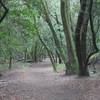
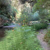
The trail climbs and descends through the forest where the trees are covered moss and ferns can be seen all around.
Jan 5, 2020 near Saratoga, CA

0 Comments

Weather


Current Trail Conditions

Unknown
Add Your Check-In

Check-Ins

none
Welcome

Join the Community! It's FREE

Already have an account? Login to close this notice.