
 Continue with onX Maps
 Continue with Facebook


 Particularly Special Place


 Intermediate
Intermediate
Intermediate
 Intermediate
Land Manager: Midpeninsula Regional Open Space
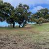
 Vista Verde Skyline Run - 10K
6.5 mi 10.5 km • 1,116' Up 340.12 m Up • 1,116' Down 340.24 m Down
 La Honda, CA
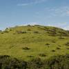
Clouds Rest - Meadow Trail Loop
La Honda, CA
Clouds Rest - Meadow Trail Loop
2.5 mi 4.0 km • 520' Up 158.64 m Up • 518' Down 157.84 m Down

 Los Trancos Loop
7.2 mi 11.5 km • 1,545' Up 470.96 m Up • 1,541' Down 469.74 m Down
Ladera, CA
Rancho Ridge Loop
13.6 mi 21.9 km • 2,279' Up 694.54 m Up • 2,280' Down 694.84 m Down
Loyola, CA
Hamms Gulch-Spring Ridge Trail Loop
7.7 mi 12.3 km • 1,440' Up 438.85 m Up • 1,439' Down 438.59 m Down
Portola…, CA
 Stanford Dish: Ranch Road via Piers Gate
2.3 mi 3.7 km • 295' Up 89.99 m Up • 295' Down 89.92 m Down


0 Comments