Trail Run Project Logo

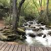
Eastatoe passage of the Palmetto Trail.


Your Rating: Rating Rating Rating Rating Rating      Clear Rating
Your Difficulty:
Your Favorites: Add To-Do · Your List
Zoom in to see details
Map Key

2.6

Miles

4.2

KM

86%

Runnable

1,183' 361 m

High

927' 282 m

Low

431' 131 m

Up

564' 172 m

Down

7%

Avg Grade (4°)

40%

Max Grade (22°)

Dogs Leashed

Features Fall Colors · River/Creek · Views · Wildlife

Western trailhead is inside Keowee-Toxaway State Park. Access only available during park hours.

Need to Know

Access only available from inside Keowee-Toxaway State Park. See park website for gate hours. $5 fee to enter park, unless you possess an annual pass. Many parts of this trail are under thin canopy, or in direct sunlight. These sections can get HOT in the summer months.

Description

There are two trailheads to this trail: the one inside Keowee-Toxaway State Park, and one at the Roy F. Jones fishing access area. This is a partial segment of the trail up to where the first bridge is/was. In April of 2019, heavy rains created a flood, which dislodged the two bridges on this passage. As of August 2019, neither bridge has been moved back into place and those sections are not currently passable.

This section begins inside Keowee-Toxaway State Park and uses part of the Natural Bridge Trail as the first portion. Once about a mile or so in, take a left and follow the sign for the Palmetto Trail. The trail will climb up a hill, winding up some switchbacks after which it flattens out and traverses a natural ridge, a few areas of which are atop slickrock. After running along the ridge, the trail descends some switchbacks and heads toward road (HWY 11).

Run across the plank bridge, climb up alongside the road, and run across the private drive. The trail continues on the other side of the drive, but this is not immediately obvious. After entering the trail on this side, follow the descent, cross an additional plank bridge, and climb back up the ridge. The trail will climb and descend several sets of switchbacks before it flattens out once again. The trail will end at the river where the dislodged fiberglass bridge lies. The river here is not passable on foot.

Contacts

Shared By:

Glint Gossamer

Trail Ratings

  2.0 from 1 vote

#45095

Overall
  2.0 from 1 vote
5 Star
0%
4 Star
0%
3 Star
0%
2 Star
100%
1 Star
0%
Trail Rankings

#284

in South Carolina

#45,095

Overall
18 Views Last Month
680 Since Aug 11, 2019
Intermediate Intermediate

0%
0%
100%
0%
0%
0%

0 Comments

Weather


Current Trail Conditions

All Clear 70 days ago
Add Your Check-In

Check-Ins

none
Welcome

Join the Community

Create your FREE account today!
Already have an account? Login to close this notice.

Get Started