Trail Run Project Logo

A rolling tour of singletrack trails lined with tall pine stands in the shadow of Eastern Cascades volcanoes.


Your Rating: Rating Rating Rating Rating Rating      Clear Rating
Your Difficulty:
Your Favorites: Add To-Do · Your List
Zoom in to see details
Map Key

64.3

Miles

103.5

KM

96%

Runnable

5,617' 1,712 m

High

4,080' 1,244 m

Low

5,935' 1,809 m

Up

5,936' 1,809 m

Down

3%

Avg Grade (2°)

16%

Max Grade (9°)

Dogs Leashed

Features Views

Seasonal snow pack may limit trail access.

Overview

A runnable forest singletrack race through lodgepole and ponderosa pines on the edge of the Eastern Cascades. In the shadow of Mt. Bachelor, you'll roll along the ridges toward the Deschutes River and the famed Deschutes National Forest.

Need to Know

Restrooms are available at the Wanoga Snow Park (start/finish area)

Description

Beginning from the Wanoga Snow Park the course moves toward Mt. Bachelor before looping back along forest roads to complete the first 10k.

From there, the race moves over the peak of Kiwa Butte via the Tiddlywinks Upper trail, then downhill towards the Deschutes River via the Tyler's Trail then onto Catch & Release.

Approaching the Cascades Scenic Byway, you'll turn uphill onto Storm King Trail then the uphill route of Funner Trail before returning to the start/finish area. Three of these larger loops complete the 100k.

The course is primarily runnable singletrack trail of packed dirt and pine needles, with occasional volcanic rocks and gravel. It is mildly technical but not challenging. There is moderate elevation gain at roughly 100ft/mile of gain and loss. No road crossings.

Flora & Fauna

Ponderosa and lodgepole pines.

Contacts

Shared By:

Brandon Mader

Trail Ratings

  3.0 from 2 votes

#5266

Overall
  3.0 from 2 votes
5 Star
0%
4 Star
50%
3 Star
0%
2 Star
50%
1 Star
0%
Recommended Route Rankings

#154

in Oregon

#5,266

Overall
10 Views Last Month
2,534 Since Apr 11, 2019
Intermediate/Difficult Intermediate/Difficult

0%
0%
50%
0%
50%
0%

Photos

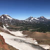
Rock formation on Funner Uphill.
Sep 16, 2020 near Deschut…, OR
Lower Storm King
Sep 16, 2020 near Deschut…, OR
loading

Weather


Current Trail Conditions

Unknown
Add Your Check-In

Check-Ins

Aug 23, 2020
Perry Cortell
Welcome

Join the Community! It's FREE

Already have an account? Login to close this notice.