
 Continue with onX Maps
 Sign in with Facebook


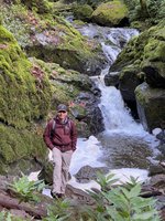
 Particularly Special Place


 Intermediate


 Intermediate
 Ridgeline Loop
4.8 mi 7.7 km • 565' Up 172.13 m Up • 545' Down 166.01 m Down
Sierra Vista Preserve Loop
4.6 mi 7.4 km • 1,052' Up 320.5 m Up • 1,052' Down 320.66 m Down
South Fork/Tolman Peak Loop
5.2 mi 8.4 km • 884' Up 269.43 m Up • 884' Down 269.31 m Down
 Snell Barn Loop
3.7 mi 5.9 km • 228' Up 69.57 m Up • 229' Down 69.66 m Down
Rancho San Vicente Loop
8.4 mi 13.6 km • 672' Up 204.86 m Up • 672' Down 204.74 m Down
Wildcat Loop
5.0 mi 8.1 km • 564' Up 171.99 m Up • 564' Down 171.84 m Down
Loyola, CA


0 Comments