Dogs No Dogs

Features
Commonly Backpacked · Lake · River/Creek · Swimming · Views · Waterfall · Wildflowers
Overview
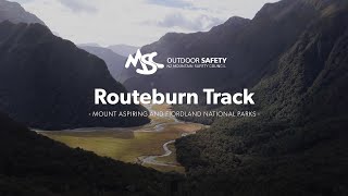
The Routeburn Track traverses wild and scenic mountain landscapes across Fiordland National Park and Mount Aspiring National Park between the Hollyford Valley and Dart Valley at the base of New Zealand's Southern Alps.
Description
The track starts at the Divide Shelter and ascends through beech forest for about 1.5 miles. Through the trees on your left you get the occasional glimpse of the snow covered mountaintops across the Hollyford Valley. The
Key Summit Track to the right is very much worth the side trip. Leave your pack at the junction and head up the mountain ridge to enjoy great panoramas in all directions. The Routeburn Track descend again to reach Lake Howden and the Lake Howden Hut at about 2 miles. This is a great spot for a break and to enjoy the views of the lake.
Leave Lake Howden to the right and continue towards the northern Ailsa Mountains. The track will steadily ascend through the beech forest until you reach Earland Falls at 4.25 miles. This section is slightly more difficult to navigate because the track is very rocky. Earland Falls is 174 m (570 ft) tall and a welcome stop for dipping your feet into the cold water. Beyond the falls, the track will meander along the tree line giving you a few great views of the Hollyford Valley. At 7 miles, you reach Lake Mackenzie (DoC managed hut and Ultimate Hikes managed lodge).
Passing the lake on the left, the track then heads up the southwest side of Ocean Peak. You reach the tree line at 7.6 miles and continue up to the Ocean Peak Corner—aptly named because you can see the ocean from here on a clear day. The track follows the contours of Ocean Peak north with the Hollyford Valley to your left and great views of the snow covered tops beyond that. At 11 miles, you begin your ascent up the Harris Saddle and reach the Harris Shelter at 11.5 miles.
Conical Hill Track is a highly recommended, but also very strenuous side trip leading you up one of the peaks with amazing vistas in all directions.
Continue further towards Lake Harris. You'll reach the highest point of the track at 12 miles offering a spectacular view of the lake and into the Dart Valley. From here, it's a long descent over a number of stairs—either wooden or carved into the rock. Routeburn Falls are the next highlight at 13.7 miles. This is a great place to relax and cool down your feet in the cold water. Next to the falls are the Routeburn Falls Lodge (Ultimate Hikes) and Routeburn Falls Hut (Department of Conservation).
The track continues downhill through beech forest. At 14.5 miles, you have another amazing view into Dart Valley from an open stretch that was the result of a tree avalanche. About a mile further you reach Routeburn Flats and the base of Dart Valley. From here it's mostly flat, and the track follows the Dart River. On a warm and clear day, a few spots along the way invite you to pause and relax at the river. At 19 miles, you cross the river one last time over an impressive bridge and reach the Routeburn Shelter.
Flora & Fauna
The flora along the track is very diverse. You'll see Large Mountain Daisies which flower between November and February. Another alpine plant is the South Island Edelweiss, particularly at Ocean Peak Corner and Conical Hill. Speargrass is another spiky alpine plant that you'll encounter.
Contacts
Shared By:
Tilman Giese

 Continue with onX Maps
 Sign in with Facebook


 Particularly Special Place


 Difficult


0 Comments