Trail Run Project Logo

This trail connects Dry Creek Road to Sedona on a well-maintained trail through beautiful scenery.


Your Rating: Rating Rating Rating Rating Rating      Clear Rating
Your Difficulty:
Your Favorites: Add To-Do · Your List
Zoom in to see details
Map Key

3.6

Miles

5.8

KM

93%

Runnable

5,073' 1,546 m

High

4,544' 1,385 m

Low

437' 133 m

Up

528' 161 m

Down

5%

Avg Grade (3°)

19%

Max Grade (11°)

Dogs Leashed

Features Views · Wildflowers · Wildlife

No motorized vehicles on the trail. A high clearance vehicle is needed to get to trailhead on Vultee Arch Road if running in that direction.

Runner Notes

A great trail run from Vultee Arch Road. Get an early start to avoid the heat.

Description

There are two trailheads for the trail--one from Sedona at the end of W. Park Ridge Drive and the other from Vultee Arch Road (a.k.a. Dry Creek Rd.). However, the trailhead on Vultee Arch Rd requires a high clearance 4x4 vehicle. I had rented a Ford Explorer and was able to get to the trailhead.

As stated, I started this run from Vultee Arch Rd. to W. Park Ridge Drive as part of a loop run with Soldier's Pass Trail. In this direction, the trail starts off flat and crosses a dry creek bed several times. The trail is relatively easy to follow. This section passes through junipers that offer some shade. Eventually, the trail begins to climb, exiting the creek bed and junipers. After about one mile, you'll have great views of the surrounding red rock.

The top of the mesa is really a pass as you are surrounded by higher elevation red rock. After passing a large peak near the trail on the right, the route begins to descend steeply. This would be a very difficult section if you run in the reverse. Short switchbacks take you down the bottom where the trail levels off again as you approach the trailhead at W. Park Ridge Drive. This is a nice one-way option if you have another vehicle at this trailhead. If not, return the way you came or follow directions for the loop run with Soldier's Pass Trail.

Flora & Fauna

If running early in the morning or at dusk, you may at least hear coyotes. The month of May has plenty of wildflowers along the trail.

Contacts

Shared By:

John Maurizi

Trail Ratings

  4.6 from 7 votes

#7235

Overall
  4.6 from 7 votes
5 Star
71%
4 Star
14%
3 Star
14%
2 Star
0%
1 Star
0%
Trail Rankings

#186

in Arizona

#7,235

Overall
19 Views Last Month
1,966 Since Jul 7, 2017
Intermediate/Difficult Intermediate/Difficult

0%
13%
25%
38%
25%
0%

Photos

Brins Mesa
May 14, 2019 near Sedona, AZ
It will be hard to keep your eyes on the trail with views this good on the descent from Brins Mesa to Sedona.
Jul 8, 2017 near Sedona, AZ
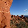
Towering cliffs north of Brins Mesa.
Apr 13, 2021 near West Se…, AZ
Cliffs over Brins Mesa
Apr 13, 2021 near Sedona, AZ
Experience great views from the top of the Brins Mesa Trail.
Jul 8, 2017 near Sedona, AZ
Atop the mesa
Jul 21, 2021 near Sedona, AZ

0 Comments

Weather


Current Trail Conditions

Unknown
Add Your Check-In

Check-Ins

Feb 5, 2024
Stefanie Jeong
Welcome

Join the Community! It's FREE

Already have an account? Login to close this notice.