Dogs Unknown

Features
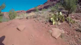
Views
Overview
This is a great loop for running or mountain biking! All skill levels will enjoy the run, but having some experience is needed if you want to explore by mountain bike.
Runner Notes
The trail is shared with hikers and mountain bikers.
Description
The Mescal Mountain Loop circles Mescal Mesa using three different trails. Park at the
Mescal Trail parking area on Long Canyon Road.
The
Mescal Trail is 2.4 miles long and winds up to the base of the mesa where it travels along beautiful, open slick rock. It is an easy run, but the trail is also open to
mountain bikers. For them, the trail is rated difficult to moderate. There are a few difficulty options pointed out by signs along the trail. I really enjoyed this portion of the run because of the cliffs of Mescal Mesa and the surrounding Secret Mountain Wilderness of Sedona. It is very picturesque.
The
Mescal Trail ends when it intersects with
Deadmans Pass. By this time, you are now on the opposite side of Mescal Mountain. Turn right and follow the trail for about one mile.
Deadmans Pass trail ends at when it intersects with the
Long Canyon Trail.
When you reach the
Long Canyon Trail, turn right. The trail travels through a section of desert not within the Secret Mountain Wilderness that surrounds it. To complete the loop, run the 1.1 mile section back to Long Canyon Road. You'll not be at the Mescal Mountain Trailhead but there is a 0.3-mile connector trail on the right that will take you back to the parking area.
In total, the loop is about 4.8 miles long and only gains about 500 vertical feet. I highly recommend this run!
Directions: From Route 89A in Sedona, turn right on Dry Creek Rd. Dry Creek Rd eventually becomes Boynton Pass Rd. At the first stop sign, turn right onto Long Canyon Rd. Parking for the
Mescal Trail on the right, and the trail is on the opposite side of the street.
Contacts
Shared By:
John Maurizi

 Continue with onX Maps
 Sign in with Facebook


 Particularly Special Place


 Intermediate

 4.5 (19)


0 Comments