Trail Run Project Logo

This longer lollipop-shaped route highlights the varied terrain of the park on a satisfying route.


Your Rating: Rating Rating Rating Rating Rating      Clear Rating
Your Difficulty:
Your Favorites: Add To-Do · Your List
Zoom in to see details
Map Key

11.2

Miles

18.0

KM

97%

Runnable

4,526' 1,380 m

High

3,964' 1,208 m

Low

839' 256 m

Up

839' 256 m

Down

3%

Avg Grade (2°)

21%

Max Grade (12°)

Dogs No Dogs

Features Birding · River/Creek · Views · Wildflowers · Wildlife

Overview

For visitors with plenty of time, this long route is the perfect way to see first hand the different ecosystems that Wind Cave National Park has to offer. Runners will be able to admire both high prairie environments as well as more riparian regions.

Need to Know

This route crosses multiple environments, so you'll want to be prepared for the sun of the high prairie and the cool shadows of the ponderosa forests. Additionally, make sure that you give wildlife on this trail the space that they deserve.

Runner Notes

This longer route features varied terrain and well maintained trail surfaces. This would be a great running route!

Description

For visitors hoping to admire the varied landscape of Wind Cave National Park, this longer loop is a must-do route. Along the way, there are sweeping vistas, rolling hills, and cool stream gullies, and visitors will enjoy taking their time to enjoy the diversity of plant and animal life along the way.

Starting from the Sanctuary trailhead, you'll begin your journey on the Sanctuary Trail. This first portion of trail is gently rolling, and this is the perfect place to take in the rolling prairie surrounding you. There aren't any obstacles here, which makes it easy to look closely at your surroundings. Sharp eyes will pick out prairie dog towns and old homesteads hidden within the tall grasses, and this adds a considerable thrill to the first part of the route.

About 3 miles into your trip, you'll come to an intersection with the Centennial Trail. You'll want to take a southern turn here, and continue on your way. You'll start to notice subtle changes in the landscape around you. As the trail continues to roll through the prairie, ponderosa pines will begin to dot the landscape with increasing frequency. The shade that these trees provide will give you much-appreciated respite on hot summer days. After about 3.7 miles, the trail will begin to drop in earnest as it continues on its way to Beaver Creek. Take some time at creek crossings to admire the riparian ecosystem around you. The cool temperatures following the valley of Beaver Creek will continue as you reach an intersection with the Centennial Spur Trail.

Take a right (heading southeast), and continue to enjoy the cool and shaded descent on the Centennial Spur Trail. Head down on this short spur, enjoying Beaver Creek, as you'll soon turn onto the Highland Creek Trail.

The Highland Creek Trail is a lovely longer trail, and you'll be taking the middle portion of the trail. This part of the run is a bit strenuous, as you'll be climbing out of the lush, riparian Beaver Creek valley to return to the high prairie that is more characteristic of the region. Luckily the grades will only be steep for a short portion of the way. You'll reach a saddle at about 6 miles and will get a reprieve from the ascent. One smaller incline will bring you near the trail junction with the Sanctuary Trail, and you'll be able to descend into the junction from there.

After you join back up with the Sanctuary Trail, you'll only have about 1/4 of the way to go. The journey from here is mostly uphill, but the grades will be gentle, and there will be much to look at and admire. You'll be coming back into the historical area of the park, and you'll again be able to pick out old homesteads through the grass. Take you time, and enjoy the final miles as you head back to your vehicle.

Flora & Fauna

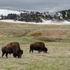
You'll be able to take in everything from pine trees to prairie grasses, and you may see mammals from prairie dogs and bison to elk and pronghorn. Various birds of prey also inhabit the area, so make sure to look up every now and again.

Contacts

Shared By:

Mikhaila Redovian

Trail Ratings

  4.5 from 2 votes

#3104

Overall
  4.5 from 2 votes
5 Star
50%
4 Star
50%
3 Star
0%
2 Star
0%
1 Star
0%
Recommended Route Rankings

#9

in South Dakota

#3,104

Overall
3 Views Last Month
1,290 Since Jul 7, 2016
Intermediate/Difficult Intermediate/Difficult

0%
0%
67%
0%
33%
0%

Photos

It gets a little rocky and steep.
Apr 9, 2016 near Hot Spr…, SD
loading

Weather


Current Trail Conditions

Unknown
Add Your Check-In

Check-Ins

none
Welcome

Join the Community

Create your FREE account today!
Already have an account? Login to close this notice.

Get Started