
 Continue with onX Maps
 Sign in with Facebook


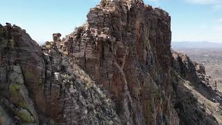
 Particularly Special Place


 Difficult
Difficult
Difficult
 Difficult
Land Manager: USFS - Coronado National Forest Office
 Bear Canyon Loop
16.9 mi 27.2 km • 2,465' Up 751.48 m Up • 2,456' Down 748.6 m Down

 Catalin…, AZ
 Bridal Wreath Falls Loop
7.3 mi 11.8 km • 1,155' Up 351.95 m Up • 1,154' Down 351.64 m Down
Romero Pools
4.9 mi 7.9 km • 1,047' Up 319.2 m Up • 1,046' Down 318.88 m Down
Oro Valley, AZ
 Canyon Loop via Horse Trail
3.1 mi 5.0 km • 285' Up 86.8 m Up • 286' Down 87.2 m Down
Honeybee Canyon Short Loop
12.3 mi 19.9 km • 456' Up 139.11 m Up • 457' Down 139.31 m Down
Catalina, AZ
 Safford Peak
3.4 mi 5.5 km • 1,490' Up 454.08 m Up • 1,489' Down 453.96 m Down


0 Comments