Trail Run Project Logo

An excellent smooth trail that is popular for Oro Valley outdoor enthusiasts.


Your Rating: Rating Rating Rating Rating Rating      Clear Rating
Your Difficulty:
Your Favorites: Add To-Do · Your List
Zoom in to see details
Map Key

13.9

Miles

22.3

KM

99%

Runnable

3,657' 1,115 m

High

3,064' 934 m

Low

684' 209 m

Up

687' 209 m

Down

2%

Avg Grade (1°)

9%

Max Grade (5°)

Dogs Unknown

Features Views

Description

This loop is simply a great fun trail in the Oro Valley area! Perfect for beginners and seasoned veterans alike. This trail overall is quite smooth and offers fairly minimal elevation gain, with the first half being gradually uphill before descending on the second half. The trail conditions are largely packed dirt with some rutted areas from rain washout. There are a few rocky sections that get a bit more technical but those are few and far between. You'll cross a number of washes but seldom will these have any water.

This trail is part of the featured run: Honeybee Canyon Loop which covers about 20.3 miles as your GPS would read when you park at the Bashas off Oracle.

Flora & Fauna

Rattlesnake have been seen here, so keep an eye out!

Contacts

Land Manager: AZ State Land Department
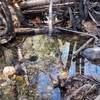
Shared By:

Stephen Woodall

Trail Ratings

  4.5 from 2 votes

#8904

Overall
  4.5 from 2 votes
5 Star
50%
4 Star
50%
3 Star
0%
2 Star
0%
1 Star
0%
Trail Rankings

#260

in Arizona

#8,904

Overall
28 Views Last Month
1,427 Since Feb 22, 2016
Easy/Intermediate Easy/Intermediate

50%
0%
50%
0%
0%
0%

Photos

Near the highest point of this loop run, with the Tortolitas in the distance and cows on the trail ahead.
Feb 5, 2016 near Catalina, AZ
A gorgeous sunrise coming up over the Catalina Mountains.
Feb 5, 2016 near Catalina, AZ
Smooth sailing through cactus on this low lying section of the path.
Feb 5, 2016 near Catalina, AZ
One of the rockier sections of the trail so don't stare at the gorgeous views too long.
Feb 5, 2016 near Catalina, AZ
Looking southeast.  ypical terrain on Honeybee Canyon Loop after turning right at the first fork: more grass and low trees.
Feb 22, 2016 near Catalina, AZ
Looking east.
Feb 22, 2016 near Catalina, AZ

0 Comments

Weather


Current Trail Conditions

Unknown
Add Your Check-In

Check-Ins

none

Join the Community

Create your FREE account today!
Already have an account? Login to close this notice.

Get Started.