Trail Run Project Logo

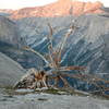
Run along the top of El Capitan to the summit for great views of Yosemite beyond the valley.


Your Rating: Rating Rating Rating Rating Rating      Clear Rating
Your Difficulty:
Your Favorites: Add To-Do · Your List
Zoom in to see details
Map Key

0.3

Miles

0.5

KM

100%

Runnable

7,594' 2,315 m

High

7,539' 2,298 m

Low

0' 0 m

Up

55' 17 m

Down

3%

Avg Grade (2°)

4%

Max Grade (2°)

Dogs No Dogs

Features Views

Can be snowy in the winter, but is accessible year round if you are equipped for the conditions.

Water can be hard to come by in the summer as Ribbon Creek dries up, so make sure you have enough water for your run.

Description

This trail isn't hard, it's the trip to get there that is the hard part. There are several options for you depending on your approach. From Tamarack Flat, its 17 miles round trip to the summit. From the Big Oak Flat Road, it's 9.7 miles to the trailhead and 5.6 miles from the top of Upper Yosemite Falls Trail (9.2 miles from the Valley Floor via Upper Yosemite Falls Trail). Another option, pick a climbing route and enjoy the climb up this granite monolith.

The trail descends gently from the North Rim Trail to to the top of El Capitan. Stunning views of the valley and the regions beyond stretch out before you as you approach the summit. North Dome, Basket Dome, Clouds Rest, Quarter Domes, Half Dome, Sentinel Dome, Sentinel Rock, Mt. Starr King, Mt. Clark, and additional peaks beyond stretch before you. The summit provides a great place to take in the view and enjoy the beauty of Yosemite.

Note: While the summit area is safe, don't go too close to the edge as it can be unsafe. The area is known for small, loose rocks that can cause a runner to slip and slide toward the edge, where it's a long drop to the valley floor. You can enjoy the view from the safety of the summit area, and possibly greet climbers as they finish their ascent of this magnificent rock formation.

Contacts

Land Manager: NPS - Yosemite

Shared By:

David Hitchcock

Trail Ratings

  4.6 from 7 votes

#843

Overall
  4.6 from 7 votes
5 Star
71%
4 Star
14%
3 Star
14%
2 Star
0%
1 Star
0%
Trail Rankings

#105

in California

#843

Overall
26 Views Last Month
27,526 Since Jan 4, 2016
Easy/Intermediate Easy/Intermediate

50%
13%
38%
0%
0%
0%

Photos

The High Sierra ridgeline from El Capitan.
Jan 17, 2021 near Yosemit…, CA
Half Dome from El Capitan
Jan 17, 2021 near Yosemit…, CA
The western end of Yosemite Valley from El Capitan.
Jan 17, 2021 near Yosemit…, CA
The last few yards to the top of El Capitan
Jan 17, 2021 near Yosemit…, CA
Rocky top of El Cap - View of Half Dome.
Dec 31, 2015 near Yosemit…, CA
On top of El Capitan, Yosemite National Park.
Feb 12, 2016 near Yosemit…, CA

0 Comments

Weather


Current Trail Conditions

Unknown
Add Your Check-In

Check-Ins

none
Welcome

Join the Community

Create your FREE account today!
Already have an account? Login to close this notice.

Get Started