Trail Run Project Logo

A forested trail with gorgeous views of Blacksmith Fork Canyon and the surrounding peaks and cliffs.


Your Rating: Rating Rating Rating Rating Rating      Clear Rating
Your Difficulty:
Your Favorites: Add To-Do · Your List
Zoom in to see details
Map Key

2.6

Miles

4.2

KM

78%

Runnable

7,200' 2,195 m

High

6,211' 1,893 m

Low

1,132' 345 m

Up

292' 89 m

Down

10%

Avg Grade (6°)

25%

Max Grade (14°)

Dogs Off-leash

Features Birding · Fall Colors · Views · Wildflowers · Wildlife

Closed January 1 through April 15 for deer and elk calving.

Runner Notes

This route is all on a four-wheeler road, so it's wide but is difficult to run in places because it is so rocky and poorly maintained. It's a really fun run, but be careful.

Description

From where the trail splits off of the main Millville Canyon road, the road immediately starts ascending through a forest that alternates between dense and sparsely populated with aspens, conifers and scrub oak, along with various other plants. The road was built basically in the bottom of a drainage, so it gets quite eroded in parts, leaving deep ruts.

The road curves up and around as it ascends through forests and meadows. After a little over a mile, it starts to level out a little bit and the ascent becomes less steep over the next half mile.

At this point, the trail reaches its apex, which also happens to be pretty devoid of trees Lack of tree coverage makes for great views of the surrounding, higher cliffs and mountains.

From this point, the trail descends gradually through sagebrush meadows and aspen forests until at last, the final ascent comes and the trail goes up steeply until it reaches an end, where a small trail goes out from the road onto an exposed hillside where you can get great views of Blacksmith Fork canyon from almost 2000' above.

Flora & Fauna

There are plenty of aspens, scrub oak, and I saw a lot moose tracks, so they definitely hang out up here.

Contacts

Shared By:

Tomsen Reed

Trail Ratings

  3.0 from 1 vote

#32692

Overall
  3.0 from 1 vote
5 Star
0%
4 Star
0%
3 Star
100%
2 Star
0%
1 Star
0%
Trail Rankings

#1,019

in Utah

#32,692

Overall
3 Views Last Month
203 Since Sep 18, 2015
Intermediate Intermediate

0%
0%
100%
0%
0%
0%

Photos

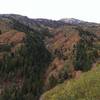
A view of the cliffs above Leatham Hollow as well as Millville Peak in the  background
Sep 18, 2015 near Hyrum, UT

0 Comments

Weather


Current Trail Conditions

Unknown
Add Your Check-In

Check-Ins

Sep 18, 2015
Tomsen Reed
Up from the mouth of Millville Canyon to the overlook and back 10mi — 2h 00m
Welcome

Join the Community

Create your FREE account today!
Already have an account? Login to close this notice.

Get Started