
 Continue with onX Maps
 Sign in with Facebook


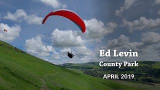
 Particularly Special Place


Trails in Ed R. Levin County Park - 5
Trail Run Project is built by runners like you. Add Your Trails
1.5
mi
2.5
km
#1Calera Creek Trail
 Intermediate
Milpitas, CA

|
Intermediate
|
Milpitas, CA |
2
|
|
|
3.0
mi
4.9
km
#2Monument Peak Road
Intermediate
Milpitas, CA
|
Intermediate
|
Milpitas, CA |
1
|
|
|
2.2
mi
3.6
km
#3Agua Caliente Trail
Intermediate
Milpitas, CA
|
Intermediate
|
Milpitas, CA |
0
|
|
|
2.5
mi
3.9
km
#4Monument Peak Trail
Intermediate
Milpitas, CA
|
Intermediate
|
Milpitas, CA |
0
|
|
0.5
mi
0.8
km
#5Sierra Trail
 Easy/Intermediate
Milpitas, CA
|
Easy/Intermediate
|
Milpitas, CA |
0
|
Photos of Ed R. Levin County Park - 5
Trail Run Project is built by runners like you. Add Your Photos


Ed R. Levin County Park Running
- 10 Miles 16 Kilometers of Trail
- 0 Recommended Routes
- 0
Easy Trails

- 5
Intermediate Trails

- 0
Difficult Trails

Trail Run Project is built by runners like you. Share
what you know about this area!
Weather Averages
|
High
|
Low
|
Precip
|
Days w/
|
| J | F | M | A | M | J | J | A | S | O | N | D |

