
 Continue with onX Maps
 Continue with Facebook


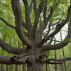
 Particularly Special Place


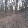
 Easy/Intermediate

 Easy/Intermediate
Land Manager: MD DNR - Palmer State Park
 Deer Creek Trail to Susquehanna Ridge Trail Loop
5.5 mi 8.9 km • 619' Up 188.61 m Up • 621' Down 189.26 m Down
 Aberdeen, MD
 Lower Susquehanna Heritage Greenway Trail
4.8 mi 7.8 km • 14' Up 4.16 m Up • 14' Down 4.17 m Down
Havre d…, MD
 Paper Mill Road Trails at NCR
4.1 mi 6.5 km • 277' Up 84.54 m Up • 277' Down 84.31 m Down
 Oregon Ridge Logger Trail Loop
2.5 mi 4.1 km • 291' Up 88.83 m Up • 296' Down 90.31 m Down
Hunt Va…, MD
Mason Dixon Trail: Lock 12 Shuttle
5.1 mi 8.2 km • 993' Up 302.63 m Up • 446' Down 136.09 m Down
Airville, PA
PHUNT 25K/50K Trail Race
15.8 mi 25.4 km • 1,498' Up 456.72 m Up • 1,498' Down 456.6 m Down
Fair Hill, MD


0 Comments