
 Continue with onX Maps
 Continue with Facebook


 Particularly Special Place


 Intermediate
Intermediate
Intermediate
 Intermediate
Land Manager: PA DCNR - Tyler State Park
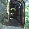
 Silver Lake and Observation Platform
1.0 mi 1.6 km • 55' Up 16.69 m Up • 55' Down 16.63 m Down
 Bristol, PA
 Wissahickon Valley Park
5.7 mi 9.2 km • 501' Up 152.76 m Up • 500' Down 152.48 m Down
Wyndmoor, PA
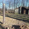
 Joseph Plumb Martin Trail
5.7 mi 9.2 km • 300' Up 91.4 m Up • 300' Down 91.4 m Down
 Audubon, PA
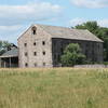
Walnut Hill Commissary & River Trails Loop
Audubon, PA
Walnut Hill Commissary & River Trails Loop
6.5 mi 10.5 km • 183' Up 55.65 m Up • 181' Down 55.14 m Down
Chester…, PA
Ridley Creek SP: Yellow-White-Yellow Loop
5.5 mi 8.9 km • 589' Up 179.62 m Up • 590' Down 179.7 m Down
Tyler Arboretum Loop
5.4 mi 8.7 km • 617' Up 187.95 m Up • 617' Down 187.95 m Down


 All Clear


0 Comments