
 Continue with onX Maps
 Continue with Facebook


 Particularly Special Place


 Intermediate
Intermediate
Intermediate
 Intermediate
Land Manager: USFS - Gallatin National Forest Office
 Spanish Creek and Jerome Rock Lakes Loop
20.3 mi 32.6 km • 3,721' Up 1134.15 m Up • 3,717' Down 1132.9 m Down

 Big Sky, MT
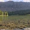
 Emerald and Heather Lakes
11.3 mi 18.3 km • 2,131' Up 649.57 m Up • 2,131' Down 649.54 m Down
Bozeman, MT
 Montana Trail 406 Section 12: Cinnamon Lodge to Emigrant
49.1 mi 79.0 km • 8,732' Up 2661.65 m Up • 10,339' Down 3151.18 m Down
Big Sky, MT
West Pine Creek
12.2 mi 19.6 km • 2,560' Up 780.37 m Up • 2,560' Down 780.22 m Down
Livingston, MT
Baldy Mountain
10.9 mi 17.6 km • 3,837' Up 1169.65 m Up • 3,837' Down 1169.42 m Down
Bozeman "M" Out-and-Back
1.9 mi 3.1 km • 811' Up 247.05 m Up • 810' Down 246.89 m Down


0 Comments