
 Continue with onX Maps
 Continue with Facebook


 Particularly Special Place


 Intermediate
Intermediate
Intermediate
 Intermediate
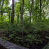
Land Manager: The Trustees - Ward Reservation
 Winnekenni Recreation Area
5.5 mi 8.8 km • 392' Up 119.33 m Up • 394' Down 119.97 m Down

 Highland Farm Loop
1.4 mi 2.3 km • 39' Up 12 m Up • 39' Down 12.01 m Down
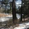
 Beaver Brook Loop
2.6 mi 4.2 km • 256' Up 78.08 m Up • 260' Down 79.11 m Down
 Belmont, MA
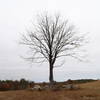
Old Town Hill Loop
Belmont, MA
Old Town Hill Loop
2.2 mi 3.6 km • 226' Up 68.94 m Up • 231' Down 70.38 m Down
Maudslay State Park Loop
3.7 mi 5.9 km • 146' Up 44.49 m Up • 145' Down 44.09 m Down
Arnold Arboretum Tour
3.6 mi 5.7 km • 282' Up 85.97 m Up • 282' Down 85.95 m Down


 Minor Issues


0 Comments