
 Continue with onX Maps
 Continue with Facebook


 Particularly Special Place


 Difficult
Difficult
Difficult
 Difficult
 Race - Jan 25, 2020
Land Manager: WSP - Moran State Park
 Orcas Island Marathon
25.4 mi 40.8 km • 5,415' Up 1650.46 m Up • 5,422' Down 1652.6 m Down
 Orcas I…, WA
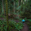
 Chuckanut Lost Lake Loop
8.1 mi 13.0 km • 1,182' Up 360.16 m Up • 1,182' Down 360.3 m Down
Lake Padden Trail Half Marathon
13.7 mi 22.0 km • 1,677' Up 511.22 m Up • 1,676' Down 510.89 m Down
 Geneva, WA
 Whistle Lake Loop
3.7 mi 5.9 km • 359' Up 109.43 m Up • 358' Down 109.11 m Down
Anacortes, WA
 Stimpson Family Nature Reserve Loop
3.1 mi 4.9 km • 369' Up 112.61 m Up • 370' Down 112.74 m Down
Sudden…, WA
Lookout Mountain Preserve Loop
4.0 mi 6.4 km • 898' Up 273.86 m Up • 883' Down 269.19 m Down


0 Comments