Trail Run Project Logo

A fun, fast, big bang-for-your-buck loop.


Your Rating: Rating Rating Rating Rating Rating      Clear Rating
Your Difficulty:
Your Favorites: Add To-Do · Your List
Zoom in to see details
Map Key

9.0

Miles

14.5

KM

97%

Runnable

5,275' 1,608 m

High

4,974' 1,516 m

Low

701' 214 m

Up

713' 217 m

Down

3%

Avg Grade (2°)

11%

Max Grade (6°)

Dogs Unknown

Features Views

Overview

This is a great alternative to one of the Dead Horse Ultra routes if you want to see the spectacular sites of Moab, but don't have time for a 30K/50K/50M. The easy-to-navigate loop takes you across rolling slick rock, silky singletrack, and a few light technical sections. Enjoy views of Monitor and Merrimack, the La Sals, and, and a big open desert. The trail is well-marked and navigation is a cinch. The trail is 100% possible to run.

Need to Know

There are a few stretches of slick rock that are incredibly off-camber. If you have ankle or achilles issues, you'll need to slow it down in these sections.

Runner Notes

While you can run this either direction, most people enjoy running it clockwise, so you go down Ramblin', rather than up it. It's a fun descent, and while mellow, it might be a slog going up.

This is a fast run, and completely runnable—although, a few stretches of slickrock are ankle-biters so some (myself included) may choose to walk on those spots.

Description

Take Highway 313 to the main Navajo Rocks parking lot (second big lot on your right if coming from town). Begin your run on Ramblin' Trail, which consists primarily of rolling slickrock and a gentle descent (you'll have a few bumps in there). Enjoy the views of Monitor and Merrimack for 3.5 miles, at the end of which you hit a parking lot.

Cross the highway here and continue on the trail, which is now named Rocky Tops. Rocky Tops is a mixture of slickrock and hard-pack singletrack that will take you along ledges, up slight climbs, and eventually down a steep series of switchbacks to some smoother, tamer trail. You won't hit a junction until about 7.8 miles—stay on Rocky Tops through this junction for another 0.2 miles.

At this point, you'll hit another junction for 7-Up or Coney Flats. Take the Coney Flats route for approximately another 0.25 miles until you hit the junction for Middle Earth. Take a sharp right onto Middle Earth for your 0.5 miles home. Enjoy some interesting rock formations and a smooth singletrack until you hit the highway and complete your loop!

Contacts

Shared By:

Amanda Simpson

Trail Ratings

  5.0 from 3 votes

#1

in Navajo Rocks

#1168

Overall
  5.0 from 3 votes
5 Star
100%
4 Star
0%
3 Star
0%
2 Star
0%
1 Star
0%
Recommended Route Rankings

#1

in Navajo Rocks

#88

in Utah

#1,168

Overall
32 Views Last Month
2,177 Since Apr 24, 2019
Intermediate Intermediate

0%
0%
67%
33%
0%
0%

Photos

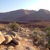
Views of Monitor and Merrimack from Ramblin'
Apr 24, 2019 near Moab, UT
Unbeatable singletrack
Apr 24, 2019 near Moab, UT
Aptly named Middle Earth trail
Apr 24, 2019 near Moab, UT
Well-marked trail but a bit off camber
Apr 24, 2019 near Moab, UT
Looking out over the namesake of the Rocky Tops Trail.
Sep 26, 2017 near Moab, UT

0 Comments

Weather


Current Trail Conditions

Unknown
Add Your Check-In

Check-Ins

Nov 26, 2020
Matt Stoub
fun loop. counterclockwise run. bikes go clockwise 9mi — 1h 45m
May 10, 2019
Gregory Sanche
9mi — 12h 35m
Welcome

Join the Community

Create your FREE account today!
Already have an account? Login to close this notice.

Get Started