
 Continue with onX Maps
 Continue with Facebook


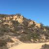
 Particularly Special Place


 Difficult
Difficult
Difficult
 Difficult
Land Manager: Irvine Open Space Preserve
 Stagecoach South Intermediate Loop
7.8 mi 12.6 km • 958' Up 291.88 m Up • 957' Down 291.78 m Down

 Laguna…, CA
Bommer Canyon-Turtle Ridge Loop
Laguna…, CA
Bommer Canyon-Turtle Ridge Loop
6.0 mi 9.6 km • 937' Up 285.58 m Up • 938' Down 286.05 m Down
Wood Canyon Cave Tour
6.0 mi 9.6 km • 239' Up 72.83 m Up • 239' Down 72.84 m Down
Aliso V…, CA
Peter's Canyon Loop
5.4 mi 8.6 km • 419' Up 127.76 m Up • 418' Down 127.38 m Down
O'Neill Park Loop Vista Trail
3.7 mi 6.0 km • 668' Up 203.7 m Up • 668' Down 203.57 m Down
Rancho…, CA
 Lookout Loop
5.3 mi 8.5 km • 562' Up 171.16 m Up • 561' Down 171.05 m Down
Villa Park, CA


0 Comments