Dogs Off-leash

Features
Birding · River/Creek · Views · Wildflowers · Wildlife

This trail can be accessed on either end. The Google mapping app will take you to the lower trailhead on the North Fork. The upper trailhead is often call Coyote Ridge Trail is accessed off of HWY 204 about 0.5 west of Tollgate store.
Need to Know
Restroom available at lower trailhead.
Description
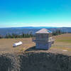
This trail is entirely within the North Fork Umatilla River Wilderness. The lower trail follows the river for about 5.0 miles. There are two campsites. The first at about 3.5 miles (just before where the trail crosses Coyote Creek) is often called the "Boy Scout Camp." The second is at the point where the trail climbs up to Coyote Ridge. The upper secton, or "Coyote Ridge" trail, traverses the steep slopes. As a south facing slope, it is a mix of open grass versus brush filled spring fed sections. The upper trail does provide spectacular views of the surrounding Blues.
Link
here to get additional information on the USFS Umatilla NF.
Flora & Fauna
The lower trail has a mix of fir and pine trees, many old growth.
Contacts
Shared By:
Greg Brown

 Continue with onX Maps
 Continue with Facebook


 Particularly Special Place


 Difficult


0 Comments