
 Continue with onX Maps
 Continue with Facebook


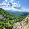
 Particularly Special Place


 Intermediate/Difficult
Intermediate/Difficult
Intermediate/Difficult
 Intermediate/Difficult
Land Manager: USFS - George Washington and Jefferson National Forest
 Ramsey's Draft Loop
16.3 mi 26.2 km • 2,633' Up 802.4 m Up • 2,637' Down 803.74 m Down


 Snarkley Route
27.7 mi 44.6 km • 9,400' Up 2865.01 m Up • 9,411' Down 2868.6 m Down
Bridgew…, VA
 VHTRC Martha Moats Baker 50 km
33.9 mi 54.6 km • 7,492' Up 2283.62 m Up • 7,503' Down 2287.01 m Down
Bridgew…, VA
Grindstone 100 Trail Race
103.7 mi 166.9 km • 21,872' Up 6666.61 m Up • 21,864' Down 6664.1 m Down
Staunton, VA
Humpback Rocks Loop
4.2 mi 6.8 km • 1,117' Up 340.53 m Up • 1,132' Down 345.11 m Down
Nellysford, VA
Humpback Rocks
1.8 mi 2.9 km • 817' Up 249.16 m Up • 817' Down 249.02 m Down
Nellysford, VA


0 Comments