
 Continue with onX Maps
 Continue with Facebook


 Particularly Special Place


 Difficult
Difficult
Difficult
 Difficult
 Clark Lake Tour
2.8 mi 4.5 km • 674' Up 205.52 m Up • 694' Down 211.54 m Down
 Gold Knob Trail
4.6 mi 7.5 km • 1,563' Up 476.29 m Up • 1,564' Down 476.6 m Down
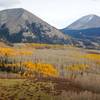
 Moab, UT
 Jimmy Keene Miner's Basin Figure 8
19.8 mi 31.8 km • 3,810' Up 1161.21 m Up • 3,807' Down 1160.38 m Down
Professor Creek & Mary Jane Canyon
8.2 mi 13.3 km • 1,105' Up 336.72 m Up • 1,105' Down 336.77 m Down
Moab, UT
Hunter Canyon Trail Out and Back
3.5 mi 5.7 km • 213' Up 64.96 m Up • 212' Down 64.68 m Down
Moab, UT
 Amasa Back/Jackson's Loop
6.7 mi 10.8 km • 989' Up 301.46 m Up • 990' Down 301.89 m Down
Moab, UT


0 Comments