
 Continue with onX Maps
 Continue with Facebook


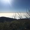
 Particularly Special Place


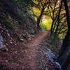
 Intermediate/Difficult
Intermediate/Difficult
Intermediate/Difficult
 Intermediate/Difficult
Land Manager: USFS - Angeles National Forest Office
 Red Box to San Gabriel Peak
3.9 mi 6.2 km • 1,422' Up 433.39 m Up • 1,422' Down 433.3 m Down

 Altadena, CA
 Chantry Flat/Mt. Wilson Loop
15.3 mi 24.6 km • 4,195' Up 1278.55 m Up • 4,183' Down 1274.84 m Down
Sierra…, CA
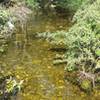
Sturtevant Falls
3.4 mi 5.4 km • 639' Up 194.74 m Up • 639' Down 194.85 m Down
Arcadia, CA
 Mt. Zion Loop
9.3 mi 14.9 km • 2,232' Up 680.18 m Up • 2,189' Down 667.06 m Down
Sierra…, CA
Eaton Falls
3.6 mi 5.8 km • 382' Up 116.53 m Up • 382' Down 116.5 m Down
Mt. Lowe Railway Ruins
5.3 mi 8.5 km • 1,344' Up 409.63 m Up • 1,344' Down 409.51 m Down
Altadena, CA


0 Comments