Dogs Leashed

Features
Fall Colors · Views · Waterfall · Wildflowers

The Top Spur Trail is usually snowed in until mid to late June. Northwest Forest Pass and Wilderness permits required. No more than 12 in a group, including pets.
Do not block vehicles or roadway at trailhead. If the trailhead is full, consider another run.
Overview
Make a 2.4-mile loop out of
Top Spur Trail #785, Pacific Crest Trail, and the
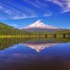
Timberline Trail #600 to circle the upper reaches of Bald Mountain with killer views of Mt. Hood and the Muddy Fork of the Sandy River Valley in the south side of Bald Mountain. This run, with its short distance and awesome view, is very popular. It is best visited on a clear day mid-week, early morning, and/or in fall.
Need to Know
Old guidebooks or old maps, may still have outdated trail designations and no mention of the cutoff trail. This trail is within the Mt. Hood Wilderness. A Northwest Forest Pass or other valid pass is required for your vehicle at the trailhead and each group must have a self-issued wilderness permit (obtained at the trailhead). Group size limit is 12 heartbeats (including pets).
Description
Top Spur Trail #785, at 0.5 mile, is a major short yet steep access trail to the Pacific Crest Trail and the
Timberline Trail #600. The trailhead was an old logging road that runners used to short cut to a higher point on the mountain. As a result, parking on this steep side hill road is limited and the trail itself, which began as a user trail, was not located well to withstand its heavy use. It is best to get there early in the day.
Begin
Top Spur Trail #785 at the trailhead (wide spot in the road). Stop at the wilderness permit box and complete a wilderness permit (tear off the upper copy and put it in the box, and tie the bottom part to someones pack - one permit per group). Follow the trail a few hundred feet to the north before it makes a large switchback and heads southeast towards the trail junctions with the PCT and Timberline Trail. The trail is rocky and has lots of eroded roots as it basically climbs the fall line in sections. You cross a small creek. After 0.5 mile, you come to the end of the trail and the intersection with the Pacific Crest Trail. Turn right on the PCT which takes you to another intersection 180 feet down the trail.
This second intersection is also known as "malfunction junction", especially if you are looking at old maps or guidebooks printed before the PCT was relocated. At this intersection (standing on the PCT facing south), the trail on your far right is the continuation of the PCT headed towards
Ramona Falls. This trail used to be called Bald Mountain, but in fact takes you down Bald Mountain. The trail on your far left is the
Timberline Trail #600 headed east towards McNeil Point and Cairn Basin. The trail in the middle is
Timberline Trail #600 headed southeast towards the Muddy Fork drainage and Bald Mountain viewpoint. Take this middle trail.
At 0.8 miles from the trailhead, you break out into talus slope on the south side of Bald Mountain with a great view of Mt. Hood and looking down into the Muddy Fork of the Sandy River. There are waterfalls visible where the Muddy Fork cascades down the steep slopes. There are also signs of landslides where the water pooled up behind an ice dam and then broke through, causing a "muddy" flow in the "sandy" soil - hence the name Muddy Fork of the Sandy River. There are large boulders here along the trail, but mind the steep drop offs and loose soil and keep dogs leashed.
Continue down through the opening for 0.3 miles and into the forest. At mile 1.3, you'll see a trail on your left (possibly marked), pointing to a short cutoff trail (
Timberline Connector) that takes you back the Timberline Trail section on the north side of Bald Mountain. Take a left on this 300 foot long cutoff trail. Do not continue straight on the Muddy Fork section of the Timberline Trail as it will take you down into the valley and back up the other side.
At the end of the cutoff trail, take a left on the Timberline Trail (taking a right leads you towards McNeil Point). Stay on this trail back to the malfunction junction and take the first right onto the Pacific Crest Trail. After 180 feet, turn left on the
Top Spur Trail #785 to return to the trailhead.
Flora & Fauna
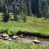
Trees include Douglas fir, mountain hemlock, western red cedar, true firs and alder. Brush includes manzanita, rhododendron, Oregon grape, salal,kinnick kinnick, and huckleberries. Wildflowers include Indian paintbrush, bear grass, lupine, dogwood, bunchberry, avalanche lilies, balsam root and other colorful beauties - especially in the large opening on the south side of Bald Mountain.
History & Background
About 450 feet past malfunction junction is a user trail on your left that heads up to the old Bald Mountain lookout remnants. Head up it and switchback left and continue up to the summit of Bald Mountain to the old fire lookout remnants (concrete footings). Trees have grown around the site but there are still great views of Mt. Hood in places.
Contacts
Shared By:
Kathleen Walker

 Continue with onX Maps
 Continue with Facebook


 Particularly Special Place


 Intermediate

 Mountaineer Loop Trail #798

 Governm…, OR
 Tamanawas Falls Hike
 Trillium Lake Loop Trail #761


0 Comments