
 Continue with onX Maps
 Continue with Facebook


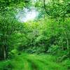
 Particularly Special Place


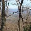
 Difficult
Difficult
Difficult
 Difficult
 Trail Running Takeover at Mulberry Gap: Emery Creek Falls
6.1 mi 9.8 km • 665' Up 202.81 m Up • 666' Down 202.94 m Down
 Chatsworth, GA
Grassy Mountain 30k
Chatsworth, GA
Grassy Mountain 30k
19.5 mi 31.3 km • 3,709' Up 1130.46 m Up • 3,705' Down 1129.17 m Down
Chatsworth, GA
 Fall Branch Falls Out-and-Back
0.9 mi 1.5 km • 207' Up 63.23 m Up • 206' Down 62.66 m Down
 Cherry Log, GA
Weaver Creek to Rocky Mountain
Cherry Log, GA
Weaver Creek to Rocky Mountain
6.7 mi 10.8 km • 1,525' Up 464.71 m Up • 1,525' Down 464.68 m Down
 Len Foote Hike Inn Loop
10.1 mi 16.3 km • 1,802' Up 549.37 m Up • 1,812' Down 552.36 m Down
 Cruel Jewel 100
100.0 mi 161.0 km • 25,409' Up 7744.6 m Up • 25,408' Down 7744.3 m Down
Blairsv…, GA


0 Comments