
 Continue with onX Maps
 Continue with Facebook


 Particularly Special Place


 Intermediate


 Intermediate
 Oak Creek Overlook
6.1 mi 9.8 km • 2,545' Up 775.86 m Up • 2,544' Down 775.52 m Down
 Old Horsethief Trail
5.1 mi 8.2 km • 2,715' Up 827.44 m Up • 2,714' Down 827.17 m Down
Weehawken Trail #206 to Alpine Mine and Overlook
5.2 mi 8.4 km • 2,182' Up 665.05 m Up • 2,181' Down 664.87 m Down
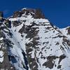
 Wetterhorn and Uncompahgre
16.4 mi 26.4 km • 5,569' Up 1697.32 m Up • 5,567' Down 1696.94 m Down
Lake City, CO
 U.S. Basin Road
6.1 mi 9.8 km • 1,149' Up 350.13 m Up • 2,045' Down 623.18 m Down
Ajax Peak
10.0 mi 16.1 km • 3,739' Up 1139.73 m Up • 3,752' Down 1143.71 m Down
Telluride, CO


0 Comments