
 Continue with onX Maps
 Continue with Facebook


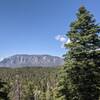
 Particularly Special Place


 Difficult
Difficult
Difficult
 Difficult
Land Manager: USFS - Cibola National Forest Office
 Otero Canyon Loop
5.5 mi 8.8 km • 640' Up 194.99 m Up • 638' Down 194.49 m Down


 Birdhouse Loop
11.4 mi 18.4 km • 1,542' Up 469.93 m Up • 1,538' Down 468.77 m Down
Carnuel, NM
Three Guns to Embudito Trailhead
7.9 mi 12.8 km • 2,277' Up 694.16 m Up • 2,368' Down 721.8 m Down
Carnuel, NM
Foothills FA 50K
31.4 mi 50.6 km • 3,594' Up 1095.44 m Up • 3,592' Down 1094.78 m Down
Sandia…, NM
North 10k Trail and Osha Loop Trail
7.6 mi 12.2 km • 1,272' Up 387.8 m Up • 1,268' Down 386.37 m Down
Fourth of July Loop
5.8 mi 9.4 km • 1,008' Up 307.36 m Up • 1,018' Down 310.27 m Down


0 Comments