
 Continue with onX Maps
 Continue with Facebook


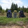
 Particularly Special Place


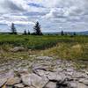
 Very Difficult
Very Difficult
Very Difficult
 Very Difficult
Land Manager: USFS - Monongahela National Forest Office
 Blackbird/Ridge Loop
10.4 mi 16.8 km • 888' Up 270.52 m Up • 888' Down 270.61 m Down

 Davis, WV
 Dolly Sods Challenge Hike - circumnavigation
27.4 mi 44.1 km • 2,829' Up 862.31 m Up • 2,829' Down 862.21 m Down
Davis, WV
Dolly Sods Wilderness
19.6 mi 31.6 km • 1,364' Up 415.85 m Up • 1,365' Down 416.06 m Down
Davis, WV
Dolly Sods Wilderness - North Day Loop
12.3 mi 19.7 km • 890' Up 271.28 m Up • 890' Down 271.31 m Down
Davis, WV
Dolly Sods Circumnavigation
25.9 mi 41.7 km • 2,478' Up 755.26 m Up • 2,481' Down 756.14 m Down
Davis, WV
Roaring Plains Circuit
12.8 mi 20.6 km • 2,203' Up 671.35 m Up • 2,237' Down 681.78 m Down


0 Comments