
 Continue with onX Maps
 Continue with Facebook


 Particularly Special Place


 Intermediate
Intermediate
Intermediate
 Intermediate
Land Manager: City of Ann Arbor, MI - Parks and Recreation
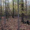
 Marshall Nature Area and Tom A. Freeman Preserve Loop
2.3 mi 3.7 km • 190' Up 58.01 m Up • 190' Down 58.04 m Down


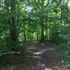
 Hewen's Creek Park
3.1 mi 5.0 km • 41' Up 12.6 m Up • 41' Down 12.59 m Down
Maybury State Park
7.3 mi 11.8 km • 433' Up 131.94 m Up • 433' Down 131.93 m Down
Joe Prance Nature Trail and Butterfly Gardens
0.9 mi 1.5 km • 15' Up 4.52 m Up • 15' Down 4.52 m Down
Dearbor…, MI
Woodstock Festival 100 Mile
17.5 mi 28.2 km • 1,035' Up 315.47 m Up • 1,036' Down 315.75 m Down
 Highland State Recreation Area
14.7 mi 23.7 km • 1,030' Up 313.92 m Up • 1,030' Down 313.86 m Down


0 Comments