
Land Manager: Los Alamos County, NM - Open Space and Trails
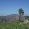
 Pajarito Ski Hill to Los Alamos North
8.7 mi 14.1 km • 770' Up 234.56 m Up • 2,500' Down 761.92 m Down
 Los Alamos, NM
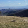
 Los Alamos Natural Arch Out-and-Back
4.3 mi 7.0 km • 806' Up 245.59 m Up • 805' Down 245.49 m Down
 Los Alamos, NM
 Anniversary Trail Loop
2.4 mi 3.9 km • 184' Up 56.03 m Up • 184' Down 56.11 m Down
Los Alamos, NM
 Los Alamos County Low Point to High Point
38.0 mi 61.1 km • 9,338' Up 2846.1 m Up • 7,914' Down 2412.07 m Down
Canada del Buey - Rio Grande Overlook
4.6 mi 7.4 km • 233' Up 71.09 m Up • 234' Down 71.46 m Down
White Rock, NM
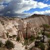
Slot Canyon Trail Out and Back
3.0 mi 4.8 km • 815' Up 248.3 m Up • 814' Down 248.14 m Down
Santo D…, NM

 Continue with onX Maps
 Continue with Facebook


 Particularly Special Place


0 Comments