
 Continue with onX Maps
 Continue with Facebook


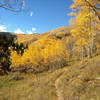
 Particularly Special Place


 Difficult


 Difficult
Land Manager: Town of Eagle, CO - Open Space Dept.
 Mountain RATS 55K
36.1 mi 58.1 km • 6,414' Up 1954.99 m Up • 6,414' Down 1954.94 m Down
Eagle, CO
 Berry Creek Tour
16.8 mi 27.1 km • 4,191' Up 1277.56 m Up • 4,191' Down 1277.55 m Down
 Hanging Lake
2.6 mi 4.2 km • 1,037' Up 316.17 m Up • 1,037' Down 316.22 m Down
Glenwoo…, CO
Minturn to Vail Back Bowls Loop
18.4 mi 29.7 km • 3,426' Up 1044.23 m Up • 3,420' Down 1042.27 m Down
Minturn, CO
Berrypicker
3.1 mi 5.0 km • 2,209' Up 673.4 m Up • 28' Down 8.44 m Down
Vail, CO
Cross Creek Out-and-Back
5.1 mi 8.1 km • 723' Up 220.42 m Up • 723' Down 220.4 m Down


0 Comments