Trail Run Project Logo

A singletrack loop through a variety of pine forests and mountain terrain with scenic views.


Your Rating: Rating Rating Rating Rating Rating      Clear Rating
Your Difficulty:
Your Favorites: Add To-Do · Your List
Zoom in to see details
Map Key

9.1

Miles

14.7

KM

92%

Runnable

9,493' 2,893 m

High

8,554' 2,607 m

Low

1,211' 369 m

Up

1,203' 367 m

Down

5%

Avg Grade (3°)

24%

Max Grade (13°)

Dogs Leashed

Features Wildflowers · Wildlife

Runner Notes

The trail is at a pretty good altitude and has quite a bit of terrain changes. Overall, expect some rocky trails through mountain terrain mixed in with some faster smooth trails. You'll go up to a high point and then back down and around.

Description

This trail is one loop option through Golden Gate Canyon State Park. Expect a variety of terrain from rocky singletrack through denser pine forest to smooth trails winding through alpine meadows. Starting at the Ole Barn Knoll, you'll climb up to Panorama Point on gradually steepening terrain along wider paths. Once past Panaroma Point, you'll be in more dense pines and eventually make your way back down through some meadow areas.

Contacts

Shared By:

Jeffrey Williams

Trail Ratings

  4.3 from 32 votes

#164

Overall
  4.3 from 32 votes
5 Star
44%
4 Star
44%
3 Star
9%
2 Star
3%
1 Star
0%
Trail Rankings

#41

in Colorado

#164

Overall
12 Views Last Month
5,595 Since May 16, 2016
Intermediate Intermediate

0%
6%
68%
13%
13%
0%

Photos

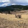
Some of the most panoramic views of the Continental Divide are east of Panorama Point.
Sep 17, 2018 near Coal Creek, CO
Near the end you'll be rewarded with a great view of the ridge you climbed at the beginning.
Sep 17, 2018 near Coal Creek, CO
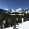
Fantastic mountain views on the Mule Deer Trail
Jun 24, 2018 near Coal Creek, CO
The last stretch to Bootleg Bottom Parking
Jun 27, 2020 near Central…, CO
Nice views of the Continental Divide just east of the Panorama Point deck/picnic area.
Sep 9, 2018 near Coal Creek, CO
The last mile of the trail starts off a little grim: Mountain Base Road on your left, private property on your right. It eventually leads to a beautiful view of the valley.
Sep 17, 2018 near Coal Creek, CO

0 Comments

Weather


Current Trail Conditions

Unknown
Add Your Check-In

Check-Ins

May 7, 2022
Jordan G
Added on part of snowshoe hare 11.9mi
May 7, 2022
Matt A
Good first long-ish run of season. Better elevation experience than running in Denver! — 2h 01m
Oct 16, 2021
Private User
Sep 4, 2021
Josh M
Aug 22, 2021
Annie Peuquet
Lovely trail and perfect in late august. Saw 1 moose and took 1 fall after the high point. More technical in terms of obstacles at your feet. 8.8mi
Jul 28, 2021
Jordan Bentley
9.1mi — 1h 40m
Jun 27, 2021
Jordan G
Beautiful, rainy, misty solitude. Didn't see a soul for the whole loop this evening. 9.1mi
May 12, 2020
Emma H-p
I walked probably a mile and a half of it. Higher altitude snowy. Relatively narrow singletrack 9.1mi — 2h 18m
Welcome

Join the Community

Create your FREE account today!
Already have an account? Login to close this notice.

Get Started