Trail Run Project Logo

A classic example of High Peaks trail construction and running


Your Rating: Rating Rating Rating Rating Rating      Clear Rating
Your Difficulty:
Your Favorites: Add To-Do · Your List
Zoom in to see details
Map Key

2.8

Miles

4.5

KM

50%

Runnable

4,833' 1,473 m

High

3,982' 1,214 m

Low

1,603' 489 m

Up

1,508' 460 m

Down

21%

Avg Grade (12°)

63%

Max Grade (32°)

Dogs Unknown

Features Fall Colors · Views

Runner Notes

Steep though runnable, keep an eye on your footing if you're planning to run this one!

Description

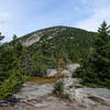
Summiting Saddleback and Basin mountains, and leading to the junction for the trail leading to Haystack, the State Range trail is technically difficult, and will challenge even experienced runners.

Gaining and losing elevation quickly, the trail isn't easy on the joints. However, the views from Basin and Saddleback, as well as the feeling of accomplishment can't be beat.

The trail ascends and descends through the upper reaches of the Adirondack forests, and you'll be surrounded by thick growths of pine trees for the duration of the trail. As with most Adirondack trails, expect plenty of roots and granite, and don't be surprised to see wooden planks in the trail- they help maintain integrity when things get wet!

Shared By:

Mikhaila Redovian

Trail Ratings

  3.0 from 1 vote

#31577

Overall
  3.0 from 1 vote
5 Star
0%
4 Star
0%
3 Star
100%
2 Star
0%
1 Star
0%
Trail Rankings

#926

in New York

#31,577

Overall
2 Views Last Month
314 Since Sep 24, 2015
Difficult Difficult

0%
0%
0%
0%
100%
0%

0 Comments

Weather


Current Trail Conditions

Unknown
Add Your Check-In

Check-Ins

none
Welcome

Join the Community

Create your FREE account today!
Already have an account? Login to close this notice.

Get Started