
 Continue with onX Maps
 Continue with Facebook


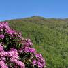
 Particularly Special Place


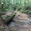
 Difficult
Difficult
Difficult
 Difficult
Land Manager: NPS - Great Smoky Mountains National Park
 Yellow Creek Falls
0.6 mi 0.9 km • 132' Up 40.34 m Up • 132' Down 40.33 m Down

 Robbins…, NC
 Fontana Dam - Shuckstack Fire Tower
9.2 mi 14.7 km • 2,371' Up 722.77 m Up • 2,371' Down 722.71 m Down
Robbins…, NC
 Lakeshore Tunnel Loop
3.2 mi 5.1 km • 690' Up 210.18 m Up • 641' Down 195.3 m Down
Tsali Ultra 50K
31.3 mi 50.4 km • 2,303' Up 701.84 m Up • 2,250' Down 685.82 m Down
Bryson…, NC
Tsali Ultra 8k
4.7 mi 7.5 km • 389' Up 118.59 m Up • 321' Down 97.73 m Down
Bryson…, NC
 Maryville Woods College Loop
2.0 mi 3.2 km • 279' Up 85.01 m Up • 270' Down 82.43 m Down


0 Comments