
 Continue with onX Maps
 Continue with Facebook


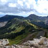
 Particularly Special Place


 Intermediate/Difficult


 Intermediate/Difficult
Land Manager: USFS - San Juan National Forest Office
 Highline Loop Trail
17.7 mi 28.5 km • 3,961' Up 1207.22 m Up • 3,950' Down 1204.08 m Down
Rico, CO
Mancos Spur Trail
24.5 mi 39.5 km • 2,430' Up 740.77 m Up • 6,217' Down 1895.07 m Down
Rico, CO
 Kennebec Mountain Run
15.2 mi 24.4 km • 3,327' Up 1014.19 m Up • 3,335' Down 1016.6 m Down
Hermosa, Clear, South Fork Creeks Loop
27.5 mi 44.3 km • 4,266' Up 1300.29 m Up • 4,265' Down 1299.98 m Down
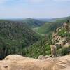
Point Lookout Trail
1.1 mi 1.7 km • 527' Up 160.75 m Up • 10' Down 3.16 m Down
Mancos, CO
Prater Ridge Trail
7.5 mi 12.1 km • 979' Up 298.47 m Up • 976' Down 297.61 m Down


0 Comments