
 Continue with onX Maps
 Continue with Facebook


 Particularly Special Place


 Difficult

 Difficult
Land Manager: BLM Utah - Moab Field Office
 Amasa Back/Jackson's Loop
6.7 mi 10.8 km • 989' Up 301.46 m Up • 990' Down 301.89 m Down
 Moab, UT
Moab Retreat: Day 1 Full Pint
Moab, UT
Moab Retreat: Day 1 Full Pint
13.8 mi 22.3 km • 1,830' Up 557.88 m Up • 1,833' Down 558.64 m Down
Moab, UT
 Hunter Canyon Trail Out and Back
3.5 mi 5.7 km • 213' Up 64.96 m Up • 212' Down 64.68 m Down
Moab, UT
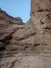
Mill Creek Waterfall Out and Back
1.6 mi 2.6 km • 68' Up 20.61 m Up • 68' Down 20.59 m Down
Moab, UT
 Moab Red Hot Trail Race
18.3 mi 29.5 km • 2,063' Up 628.88 m Up • 3,033' Down 924.52 m Down
Moab, UT
Moab Retreat: Day 3 Half Pint
10.1 mi 16.3 km • 885' Up 269.79 m Up • 885' Down 269.83 m Down


1 Comment