
 Continue with onX Maps
 Continue with Facebook


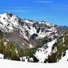
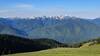
 Particularly Special Place


 Intermediate/Difficult
Intermediate/Difficult
Intermediate/Difficult
 Intermediate/Difficult
Land Manager: National Park Service - Olympic National Park
 Murhut Falls Trail #828
1.5 mi 2.5 km • 236' Up 72.05 m Up • 241' Down 73.56 m Down

 Brinnon, WA
 Royal Basin Out and Back
15.6 mi 25.1 km • 3,262' Up 994.15 m Up • 3,264' Down 994.76 m Down
Sequim, WA
 Lake of the Angels (Putvin Trail #813) Out and Back
6.5 mi 10.4 km • 3,280' Up 999.75 m Up • 3,279' Down 999.43 m Down
Seabeck, WA
Gladys Divide
17.6 mi 28.3 km • 4,331' Up 1320.08 m Up • 4,331' Down 1320.12 m Down
Belfair, WA
Hurricane Hill Nature Trail Out and Back
3.2 mi 5.2 km • 702' Up 214.1 m Up • 703' Down 214.3 m Down
Port An…, WA
Heather Park Loop
11.8 mi 19.0 km • 4,730' Up 1441.72 m Up • 4,758' Down 1450.18 m Down
Port An…, WA


0 Comments