
 Continue with onX Maps
 Continue with Facebook


 Particularly Special Place


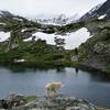
 Easy/Intermediate

 Easy/Intermediate
Land Manager: USFS - South Park Ranger District
 McCullough Gulch Waterfall Out and Back
2.3 mi 3.7 km • 465' Up 141.8 m Up • 465' Down 141.59 m Down
 Brecken…, CO
Mohawk Lakes
Brecken…, CO
Mohawk Lakes
4.3 mi 6.9 km • 1,267' Up 386.08 m Up • 1,266' Down 385.82 m Down
Brecken…, CO
Colorado Trail: Copper Mountain to Camp Hale
18.7 mi 30.1 km • 3,010' Up 917.31 m Up • 3,440' Down 1048.64 m Down
Copper…, CO
Sherman-Sheridan from Iowa Gulch
5.9 mi 9.5 km • 2,776' Up 846.02 m Up • 2,777' Down 846.34 m Down
 Peaks Trail
8.0 mi 12.9 km • 1,213' Up 369.65 m Up • 307' Down 93.49 m Down
Frisco, CO
 Ten-Mile Range Traverse
19.0 mi 30.6 km • 7,047' Up 2148.01 m Up • 6,525' Down 1988.74 m Down
Frisco, CO


 Minor Issues


0 Comments