
 Continue with onX Maps
 Continue with Facebook


 Particularly Special Place


 Intermediate
Intermediate
Intermediate
 Intermediate
Land Manager: California State Parks - South Yuba River State Park
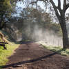
 Shingle Falls
5.3 mi 8.6 km • 538' Up 164 m Up • 538' Down 163.89 m Down
 Beale A…, CA
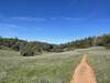
Hidden Falls Loop
Beale A…, CA
Hidden Falls Loop
8.6 mi 13.8 km • 811' Up 247.31 m Up • 812' Down 247.45 m Down
 North A…, CA
 Stevens Trail
7.7 mi 12.4 km • 1,275' Up 388.71 m Up • 1,276' Down 388.84 m Down
Colfax, CA
Foresthill Divide Loop
11.2 mi 18.0 km • 1,087' Up 331.19 m Up • 1,087' Down 331.23 m Down
Auburn…, CA
Tour de Table Mountain - Phantom Falls Loop
6.9 mi 11.1 km • 783' Up 238.69 m Up • 783' Down 238.51 m Down
Oroville, CA
 Western States Endurance Run
96.9 mi 156.0 km • 16,647' Up 5073.91 m Up • 21,596' Down 6582.45 m Down
Sunnysi…, CA


0 Comments