
 Continue with onX Maps
 Sign in with Facebook


 Particularly Special Place


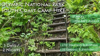
 Very Difficult
Very Difficult
Very Difficult
 Very Difficult
Land Manager: National Park Service - Olympic National Park
 Third Beach
4.5 mi 7.3 km • 410' Up 125.05 m Up • 410' Down 124.98 m Down

 Forks, WA
Second Beach
Forks, WA
Second Beach
1.7 mi 2.7 km • 273' Up 83.16 m Up • 273' Down 83.15 m Down
Forks, WA
 Hole-in-the-Wall Trail
3.4 mi 5.5 km • 52' Up 15.91 m Up • 54' Down 16.31 m Down
Forks, WA
Oil City Trail
2.1 mi 3.4 km • 115' Up 35.06 m Up • 112' Down 34.27 m Down
 North Wilderness Beach Route: Shi Shi Beach to La Push
31.6 mi 50.8 km • 925' Up 281.97 m Up • 956' Down 291.24 m Down
Forks, WA
Mt. Muller
12.2 mi 19.7 km • 3,962' Up 1207.75 m Up • 3,946' Down 1202.81 m Down
Forks, WA


0 Comments