Dogs Off-leash

Features
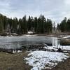
Birding · Fall Colors · Historical Significance · Views · Wildflowers · Wildlife
Description
This trail has two main access points--The trailhead at the end of Barton Road and the Blackrock trailhead on the south east end of the trail. Both lots are large parking areas, and accessible by most vehicles. The Barton Road trailhead is certainly easier to access from Pocatello proper. The summit has several communications towers, but it also has stellar views of the surrounding area, including the Snake River Plain, Big Southern Butte, and the Lost River Range to the north.
Contacts
Shared By:
Keaton Reed

 Continue with onX Maps
 Continue with Facebook


 Particularly Special Place


 Intermediate/Difficult


 Minor Issues


0 Comments