
 Continue with onX Maps
 Continue with Facebook


 Particularly Special Place


 Intermediate/Difficult
Intermediate/Difficult
Intermediate/Difficult
 Intermediate/Difficult
Land Manager: USFS - Shasta & Trinity National Forest Office
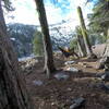
 Granite Lake
9.8 mi 15.8 km • 1,953' Up 595.24 m Up • 1,952' Down 594.97 m Down

 Lewiston, CA
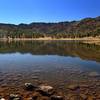
 Emerald and Sapphire Lakes
27.1 mi 43.7 km • 3,991' Up 1216.37 m Up • 3,992' Down 1216.67 m Down
Weaverv…, CA
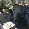
 Grizzly Lake from China Spring
13.8 mi 22.2 km • 4,618' Up 1407.49 m Up • 4,618' Down 1407.69 m Down
Weaverv…, CA
East Boulder Lake Loop
9.2 mi 14.8 km • 1,992' Up 607.06 m Up • 1,992' Down 607.02 m Down
Boulder Creek Falls (South Shore Drive Access)
5.6 mi 9.0 km • 1,056' Up 321.88 m Up • 1,055' Down 321.69 m Down
Flanagan Trail to Chamise Peak
5.2 mi 8.4 km • 767' Up 233.86 m Up • 767' Down 233.84 m Down
Central…, CA


0 Comments